
When: 7 days, August 10-16, 2019
Where: Sequoia and Kings Canyon National Parks
Mileage: About 75 miles
Overview
In August 2019, I completed a seven-day solo trip through Sequoia-Kings Canyon National Park, emerging from the wilderness on my 40th birthday. A great way to celebrate, in my opinion!
The trip was to be a lollipop, starting and ending at Crescent Meadow, the start of the popular High Sierra Trail. I would follow the HST as far as Wallace Creek, where I would then turn northwest along the unmaintained Colby Pass Trail, and return to Crescent Meadow via Elizabeth Pass, also unmaintained.
It had been a big snow year in the Sierra Nevada mountains, and I studied satellite imagery, watching the snow slowly recede each week. My route took me over two passes at elevations of around 12,000 feet. Snow sticks around for a long time at these elevations, especially on the north side of passes, which get less sunshine. The snow melts and freezes, developing a slick, hard, and uneven surface that makes travel difficult. A slip like that on a mountain ridge could mean death or serious injury.
Since I was traveling solo, I wanted to manage my risk by avoiding these kinds of situations. I pushed my trip from July into August, and consulted with rangers right up until the moment I hit the trail.
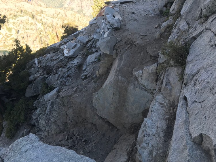
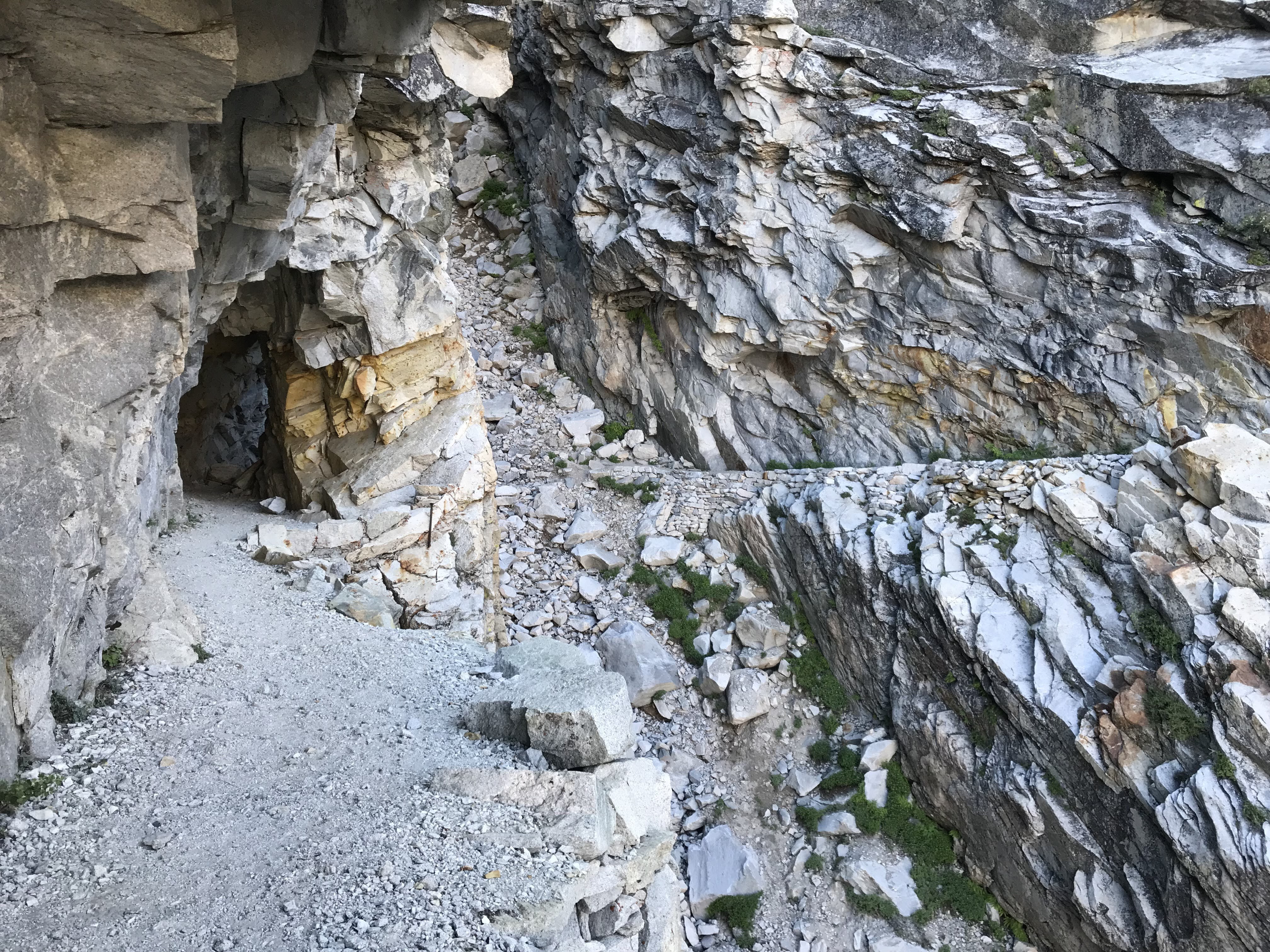
The big snow year had also blown out an eight-foot part of the High Sierra Trail above Hamilton Lakes, leaving a precipitous drop-off. Many hikers had turned back at this point, while others found a way to cross. With daily foot traffic and rain events, the conditions could be quite different by the time I got there, so I wouldn’t really know what to expect until I put eyes on it myself.
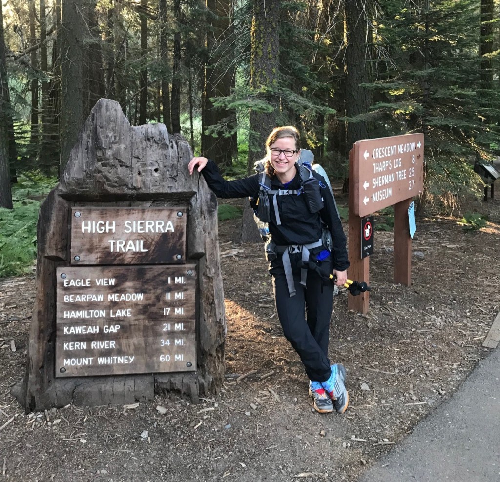
Day 1: Crescent Meadow to Hamilton Lake
I started out from Crescent Meadows at 7:30 a.m. My destination for the day was Hamilton Lake, 16.5 miles away and 5,000 feet of elevation gain.
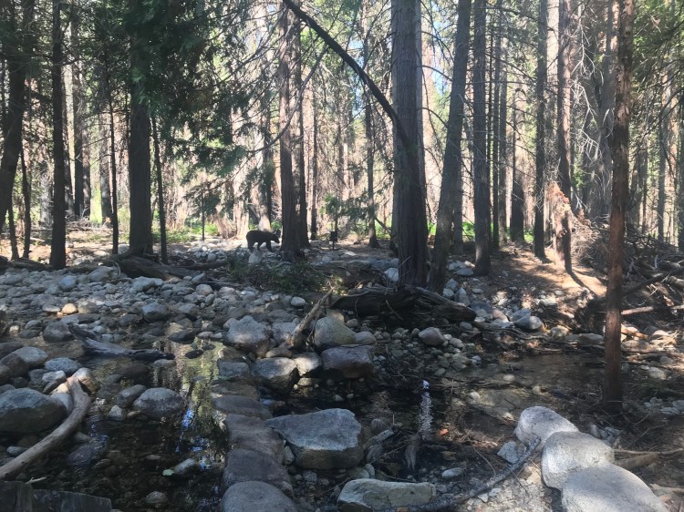
The first 11 miles of trail up to Bearpaw Meadow climbed gently through the forest. One mile in, a rustle in the bushes upslope caught my attention just in time to see a fat, furry butt running away from me. My first on-trail bear sighting! This was already a great trip!
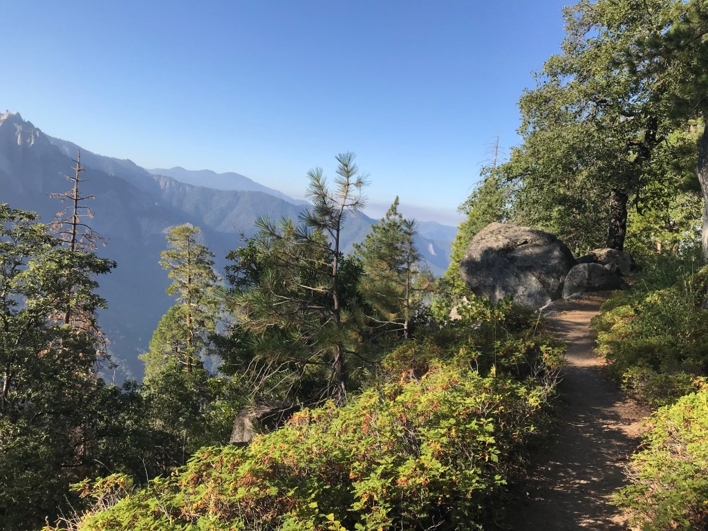
At Buck Creek, views really started opening up. The next 6 miles or so would be some of the most scenic of the route. The terrain climbed elevation and then lost most of it again, all the while, the saddle that lead to Hamilton Lake loomed high above in the distance.
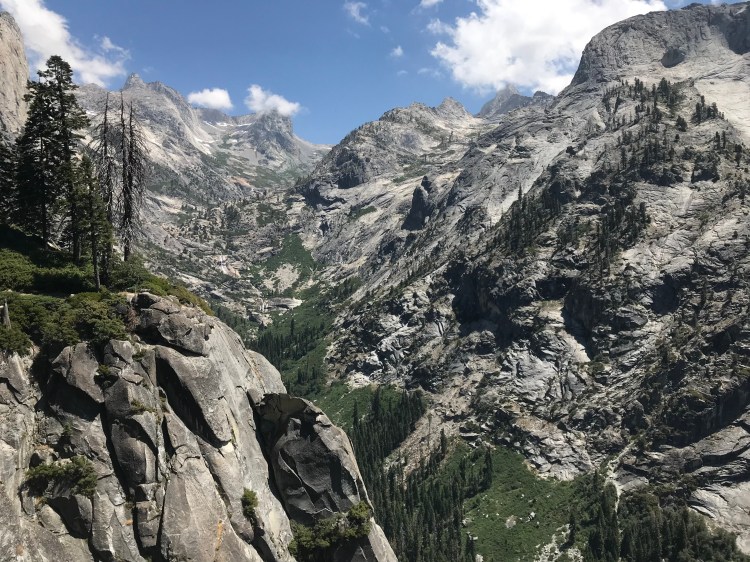
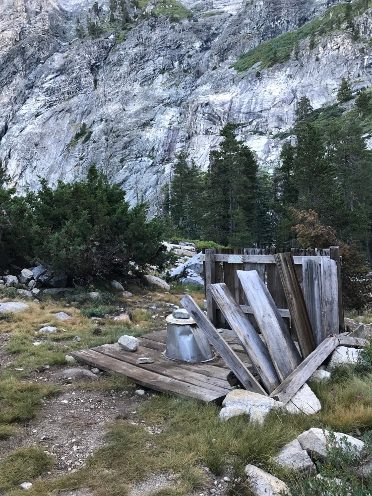
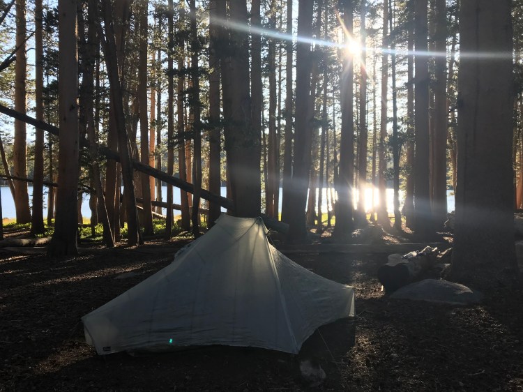
Weary and hot after 16 miles and 5,000 feet of elevation gained, I stumbled into the campsites at Hamilton Lake around 3:00 p.m. It was hopping, with a number of tents already scattered about, which I expected at this popular destination. Normally this would put me off, but I was so happy to be back in the mountains that I didn’t mind a little camaraderie.
Day 2: Hamilton Lake to Morraine Lake
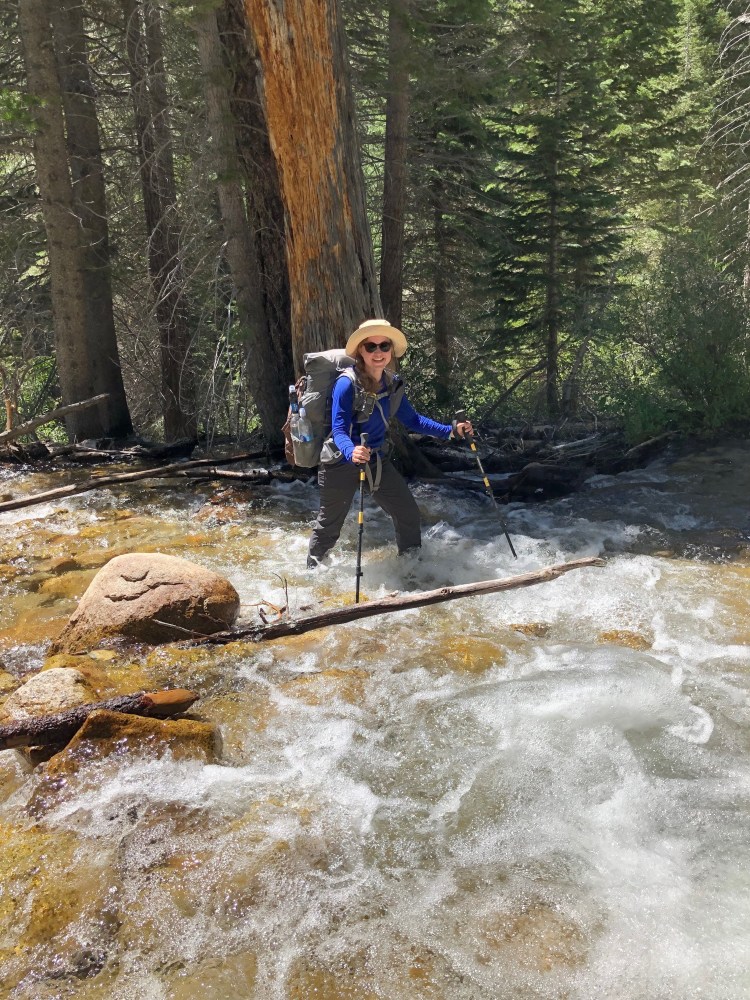
I woke up anxious to hit the trail. Somewhere above my campsite was the trail blowout, and I was eager to see if I’d be able to negotiate it. I had hoped, with the number of people camped at Hamilton Lake, that I might have some company on the trail–someone to bounce strategy off of, or to work cooperatively to cross it. But no luck. I wasn’t about to sit around and wait. I packed up and got going by 7:30 a.m., climbing up and around the lake along, enjoying wildflowers as the sun cast shadows on the lake basin below.
One hour later, I arrived at the blowout. About eight feet of trail were just missing, requiring a careful scramble down to the loose rock below, and then climbing back out on the other side. I rested and evaluated the scene, plotting out every step, handhold, and potential hang up. When I felt reasonably comfortable with my plan, I took a deep breath to calm my nerves and proceeded down into the gap and back up the other side. No problem!
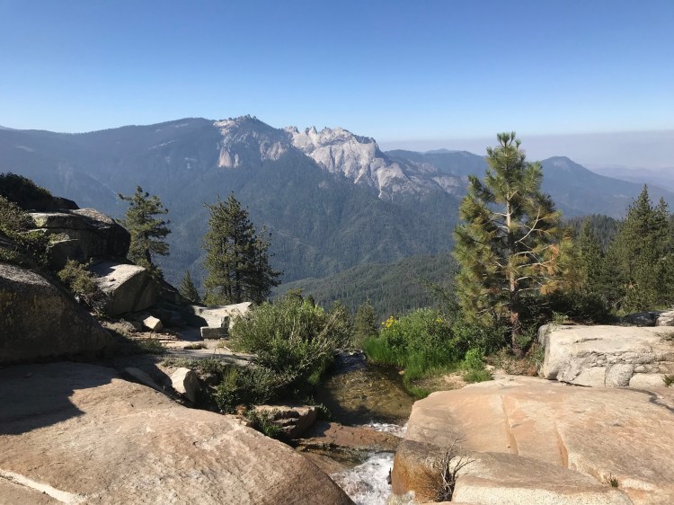
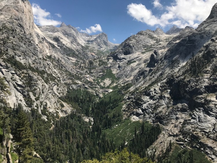
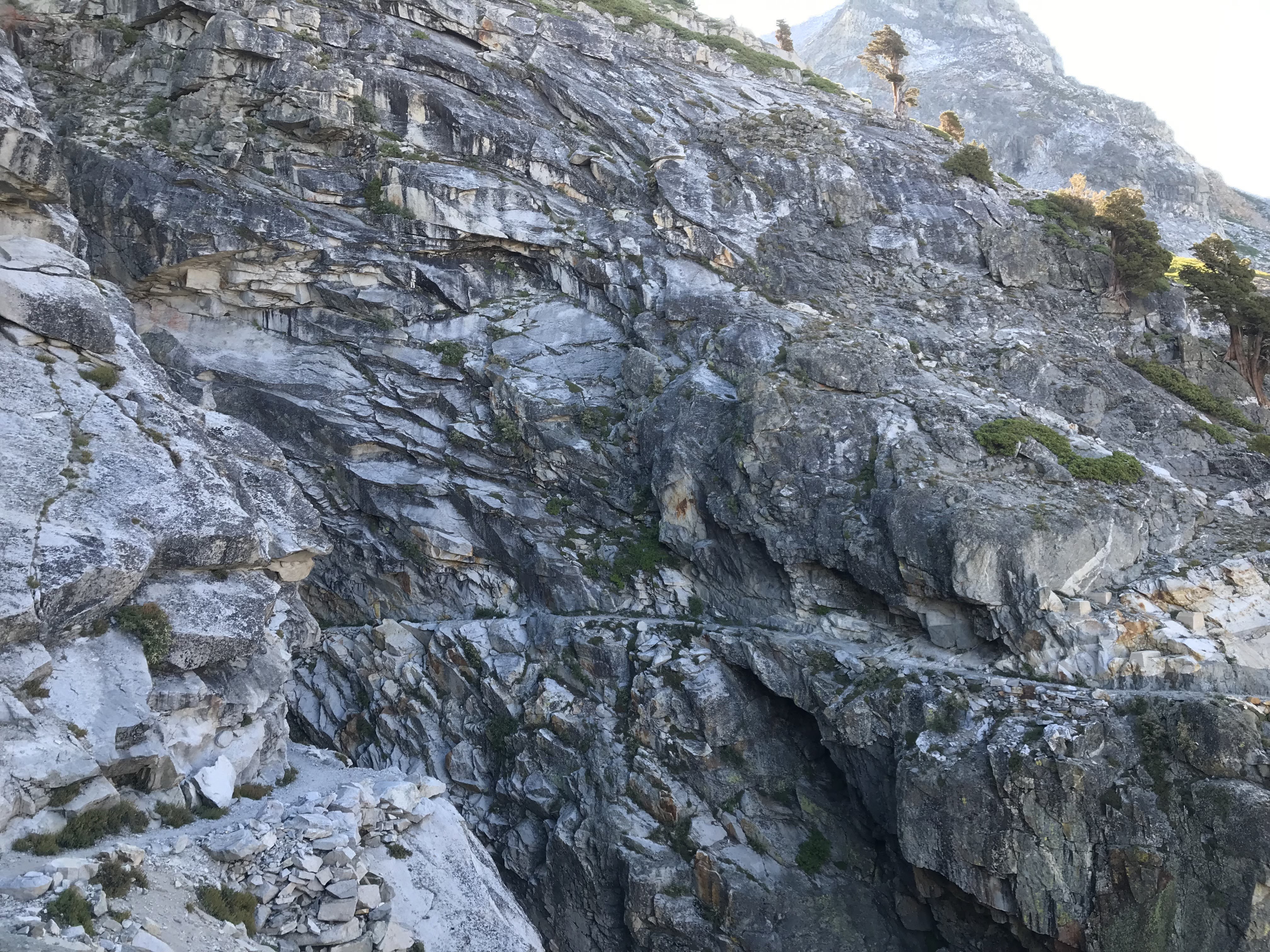
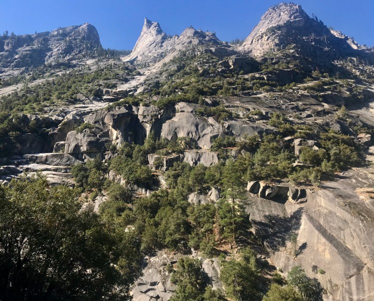
From there it was a slow and steady three-mile climb to Kaweah Gap, climbing 2,500 feet along some of the most magnificently engineered trail I have seen.
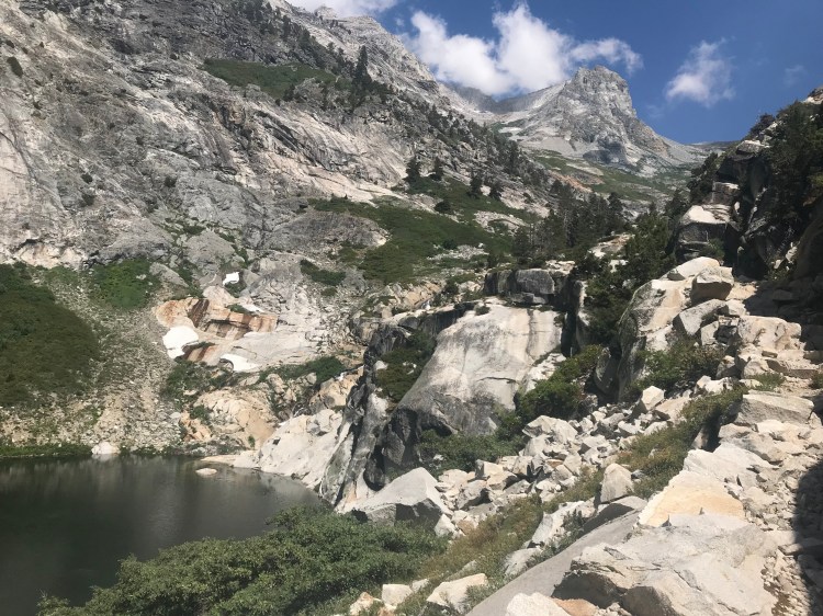
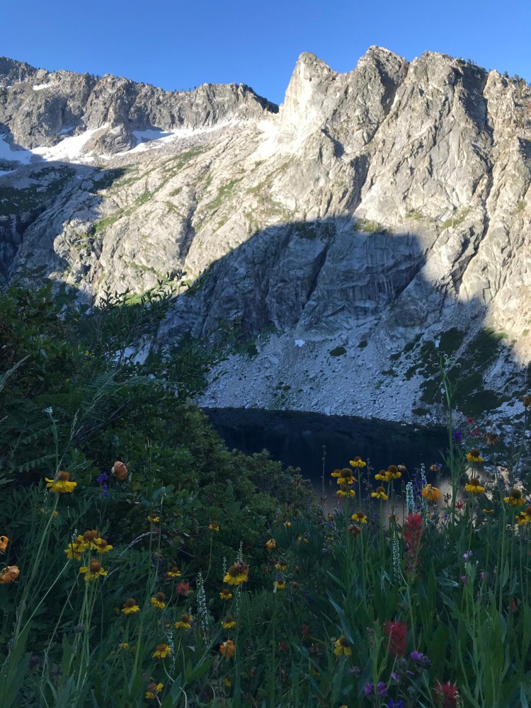
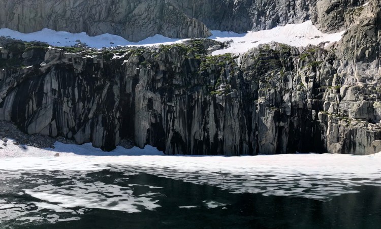
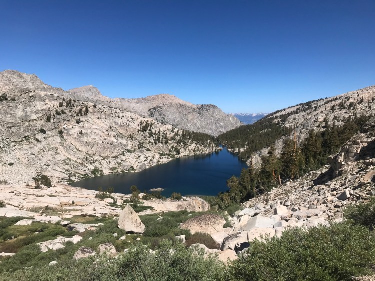
Just before reaching the gap, I arrived at Precipice Lake, a spot I had been so eager to see. The fatigue and altitude, however, were hitting me. With a sore throat and a bloody nose, I didn’t stay long. Navigating a few minor snow fields, I was up and over Kaweah Gap, gazing down into Big Arroyo.
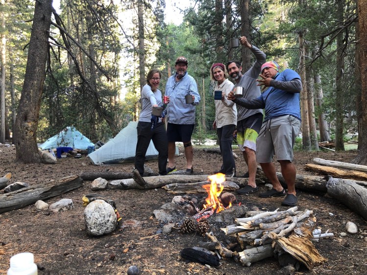
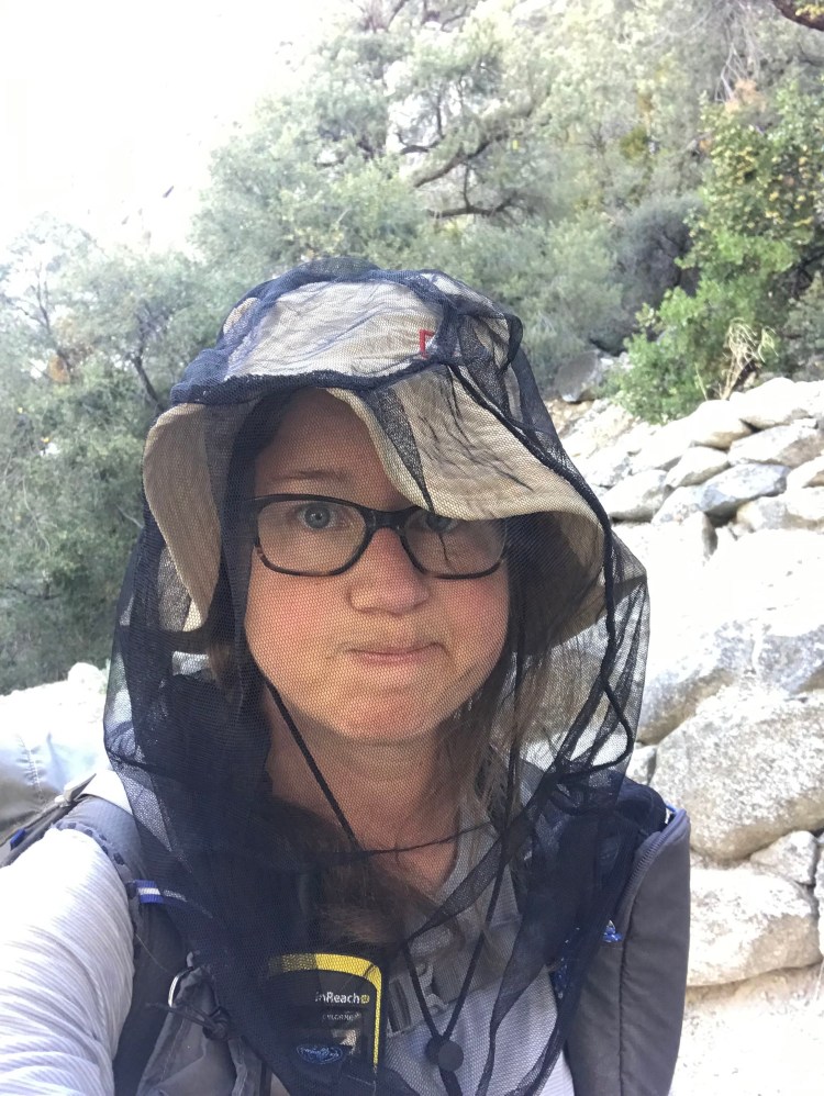
After a steady climb out of Big Arroyo, I would have liked to have found a lovely little campsite. It didn’t work out that way. Instead, I found myself in a hot and dusty forest, and the mosquito situation was not good. Despite my fatigue, I was compelled to press on for another 2.5 miles to Moraine Lake. Thankfully, I caught up to a trio from San Diego I had met at Hamilton Lakes the night before. These kind souls shared the most delicious Ruffles I have ever eaten! Having the same destination in mind, we all arrived at the lake around 5:00 p.m. I enjoyed their companionship, a short swim, dinner, and a swig of Fireball, courtesy of my new friends. I crawled into bed at 8:30 p.m.
It had been a long, hot, tough second day. Packing two 15-mile days back to back so early in the trip was a lot to take on, especially having come from sea level.
Day 3: Moraine Lake to Junction Meadow
I woke up feeling better acclimated and rested. The day started with a steep, rocky descent into the Kern River Valley. Along the way, I spooked a rattlesnake not more than a couple feet off trail. Yikes!
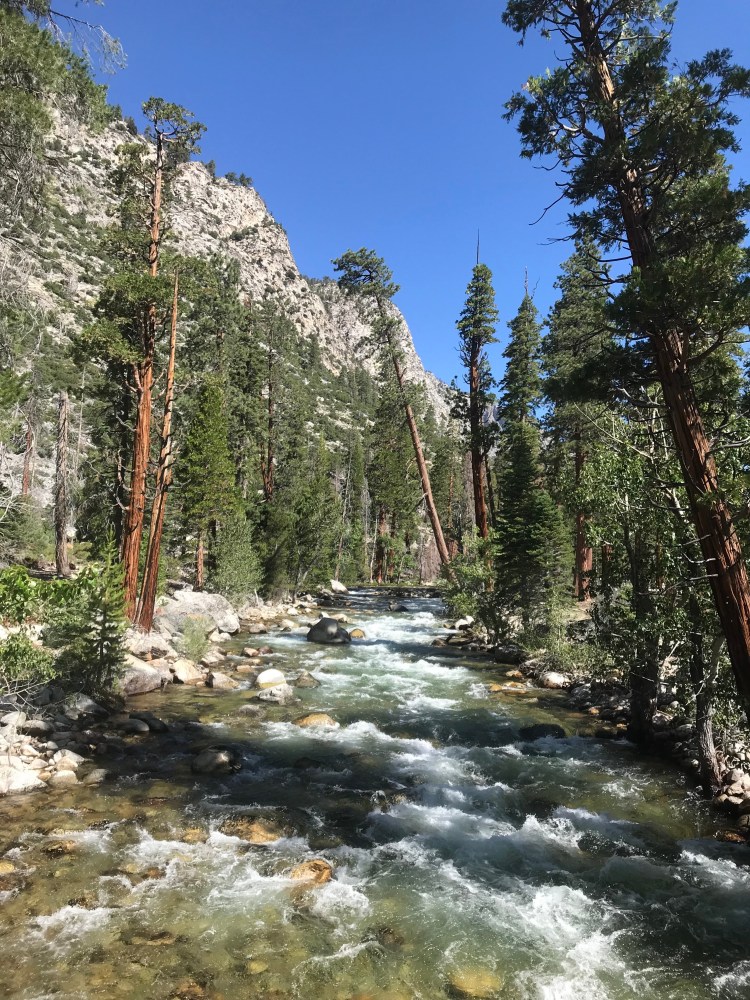
After dropping down, the trail crosses the river and then runs parallel to it for miles, but separated by thick trees. So the hot and dusty trail undulates along without the benefit of views. The Kern Hot Springs were a nice place for a long break, and the river crossings provided chances to cool off on an otherwise hot and monotonous day.
I arrived at Junction Meadow mid-afternoon. It had a number of nice campsites along a quiet stretch of the Kern River. The San Diego contingent camped there as well. As I would be splitting off from the High Sierra Trail the next morning, they were sure to send me off to bed with a shot whiskey for my birthday.
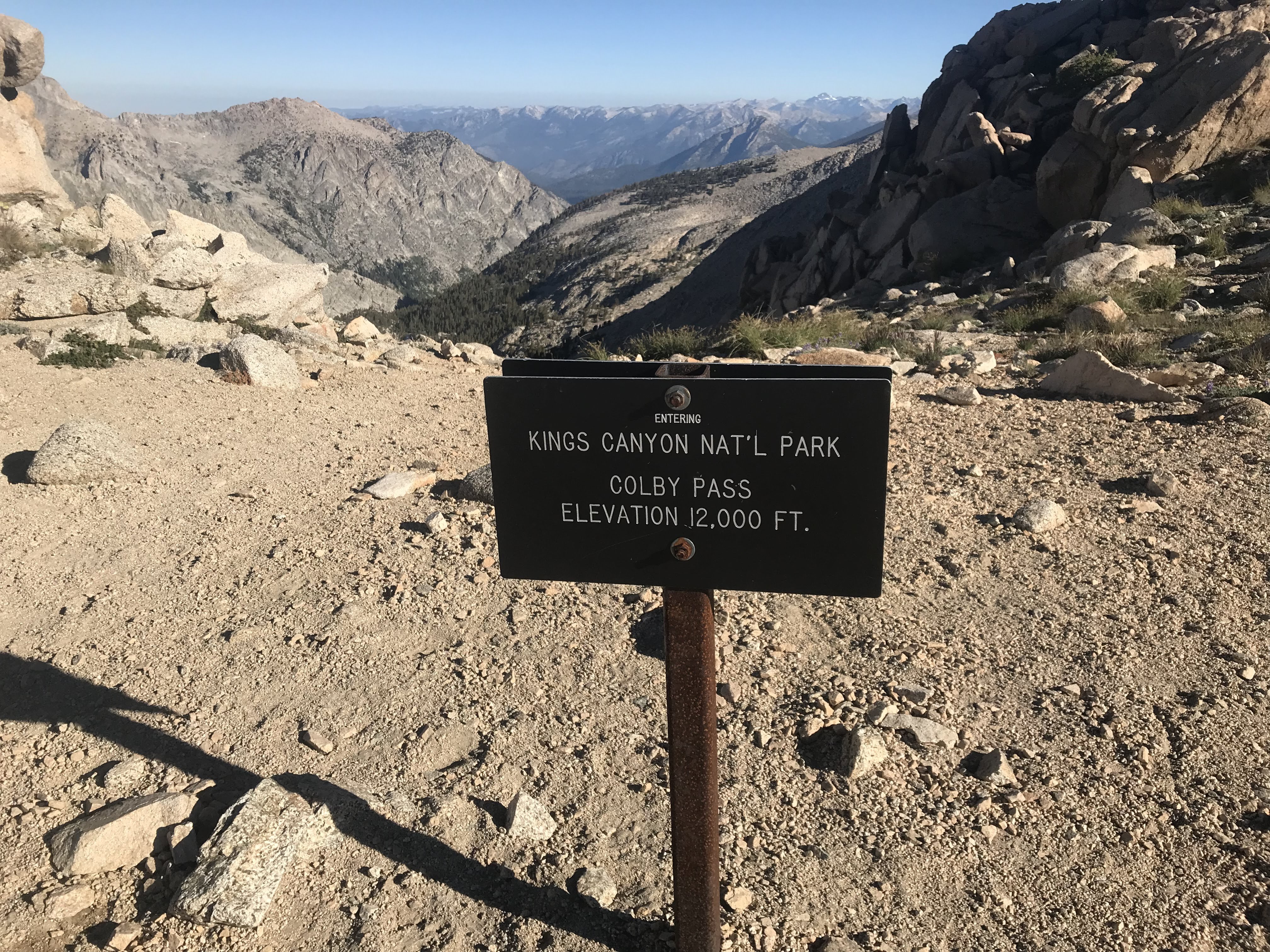
Day 4: Junction Meadow to Colby Pass
I got an early start at 6:30 a.m., unsure of what to expect as I diverted off the well-traveled High Sierra Trail onto an unmaintained trail that would take me over Colby Pass. The trail was quite faint but mostly easy to follow by using a little trail sense and taking my time. The first few miles were peaceful and quite lovely. Even though I had woken up with a bit of a tummy ache, the day held so much promise. I had no idea was I was in for.
A couple hours in, I encountered two women coming the opposite direction, so I was able to get some intel on Colby Pass, one of the unknowns on my route. It still had snow on it, they said, and they used microspikes. I had left mine in the car. Oh well! The women seemed to think it’d be navigable without them. I’d soon find out for myself.

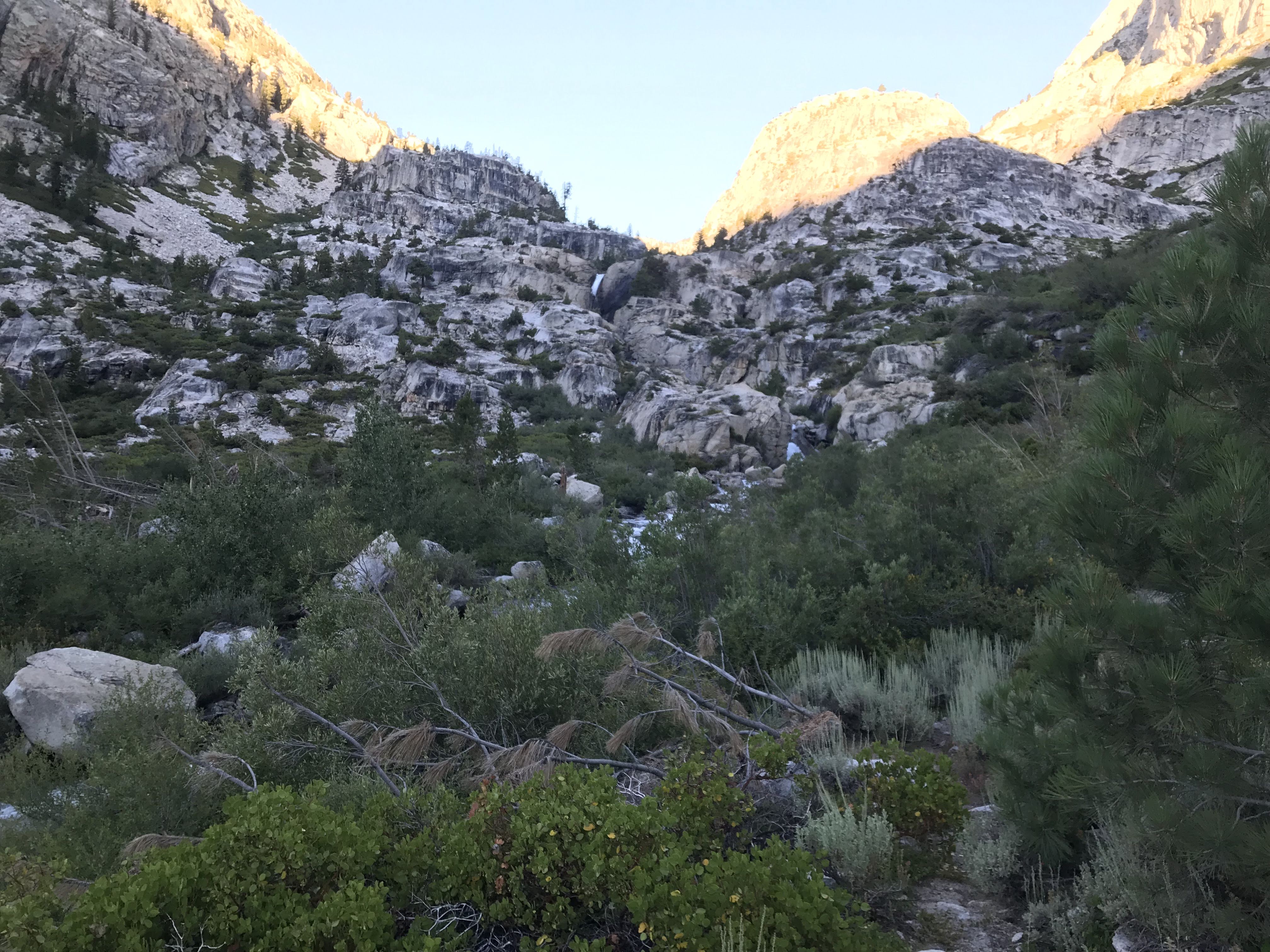
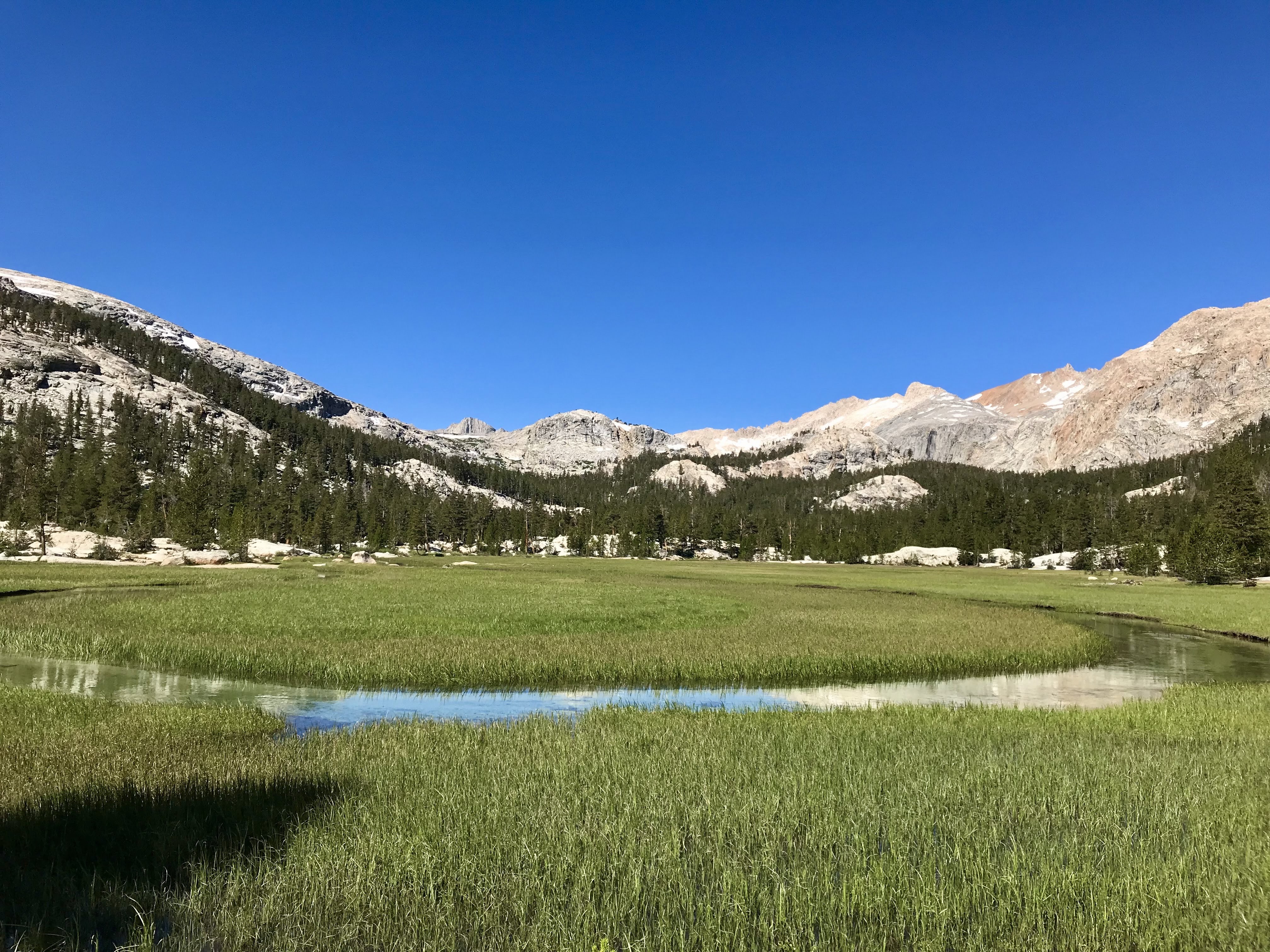
After crossing a gorgeous meadow with a meandering creek, the gentle climb toward the pass soon became severe. I found myself struggling up impossibly steep, poorly graded switchbacks that never seemed to end. My tummy troubles had only gotten worse as the day wore on. And to top it off, I was being followed by a very loud, very rude, and very persistent fly. Much swatting and swearing ensued as I worked my way slowly upward.
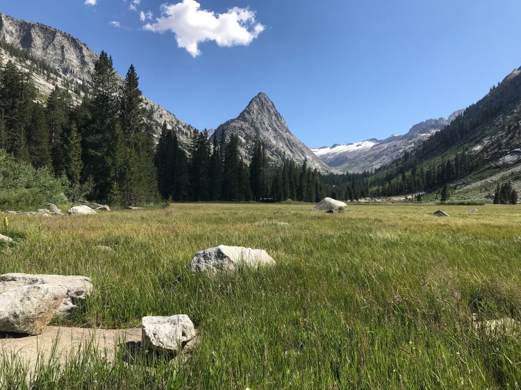
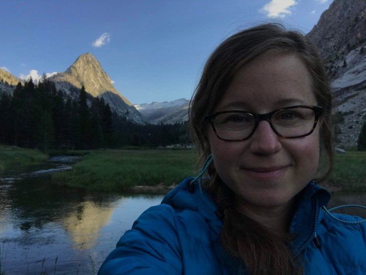
Eventually I topped out and came into a stunning meadow with 360-degree Sierra views and a delightful bubbling creek. I flopped down, and I cried. (Look, every backpacking trip involves tears at some point.) I lamented my fatigue. I lamented the fly. I lamented my tummy. I lamented how low my supply of toilet paper had gotten. Then I fell asleep. It was noon.
Soon I woke up, tried to eat, and consulted my map. I was about a mile below the pass. Could I make it over? I pitied myself and fell asleep again.
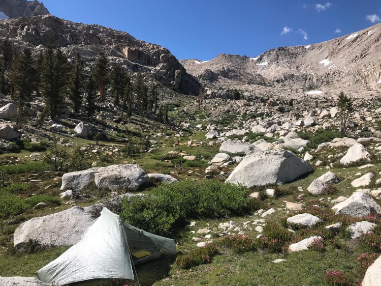
I repeated this cycle a couple more times before I decided to be rational. I would not be going over the pass today, plain and simple. I was tired, and my decision-making would be compromised, and I’d be heading over a pass that had significant snow on the other side. Cutting my day short was the smart and safe thing to do. I’d tackle the pass with fresh legs and a fresh mind in the morning. I set up my tent.
I also accepted that with my decision, I would need to alter my route and exit early. I tried not to beat myself up over it, with mixed results. I did laundry. I tried to enjoy the view. I threw mini pity parties for myself. I went to bed at 6:00 p.m.
Traveling on unmaintained trails proved to be slow going. After covering an average of 14 miles per day over the first three days, I covered only 6 miles today. Thankfully, I had planned potential bailout options before getting on trail, a best-practice for any hiker. I decided I would exit at Road’s End, cutting my total mileage by 20 miles, from 95 to 75. Since I would only need to average 8 or 9 miles a day for the next three days, I could slow down and enjoy the journey. Deadman’s Canyon and Elizabeth Pass would have to wait.
Day 5: Over Colby Pass to Big Wet Meadow
I got an early start toward Colby Pass, which was just about a mile away. And almost immediately, I lost the trail. Even my GPS was useless. Eventually, by following the small creek, I was able to pick up the trail again. I traveled half of a mile in an hour, less than a quarter of my usual pace! Once back on track, the trail consisted of steep, loose gravel but was easy enough to follow. In another hour, I was at the 12,000-foot Colby Pass.
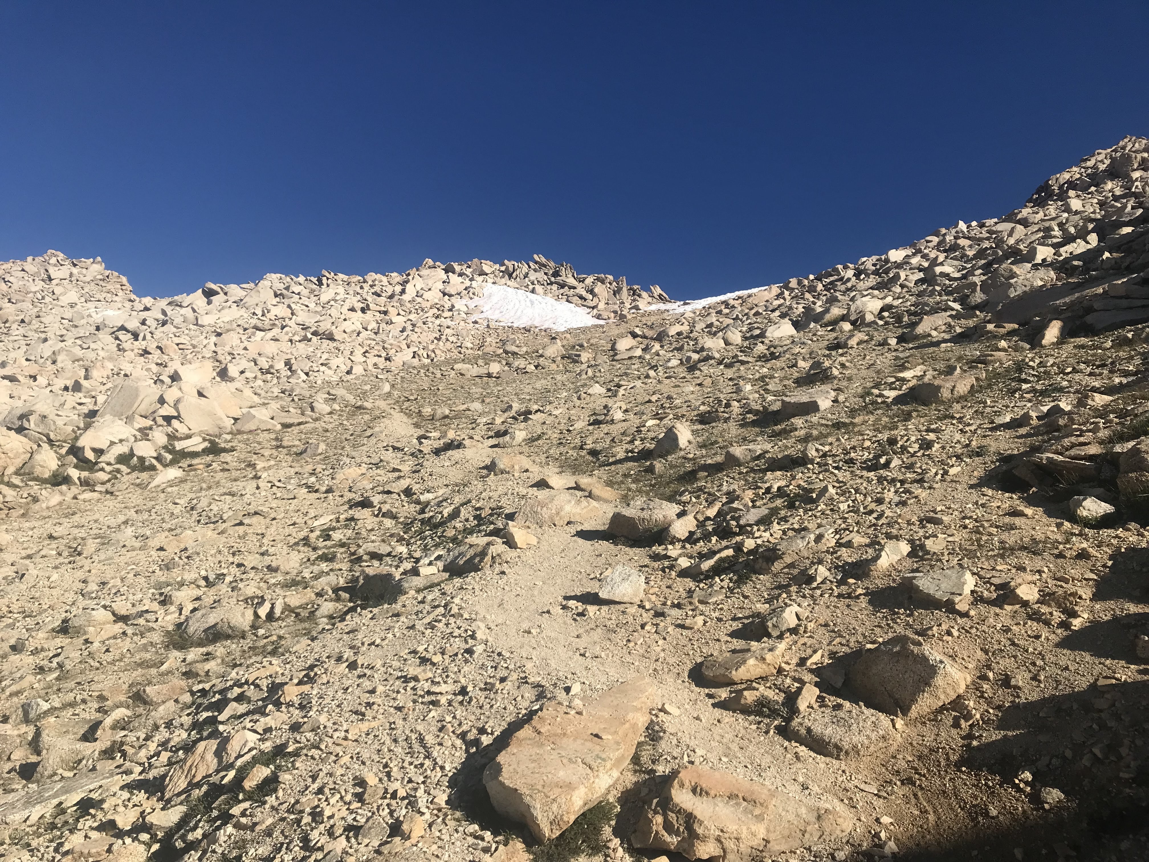
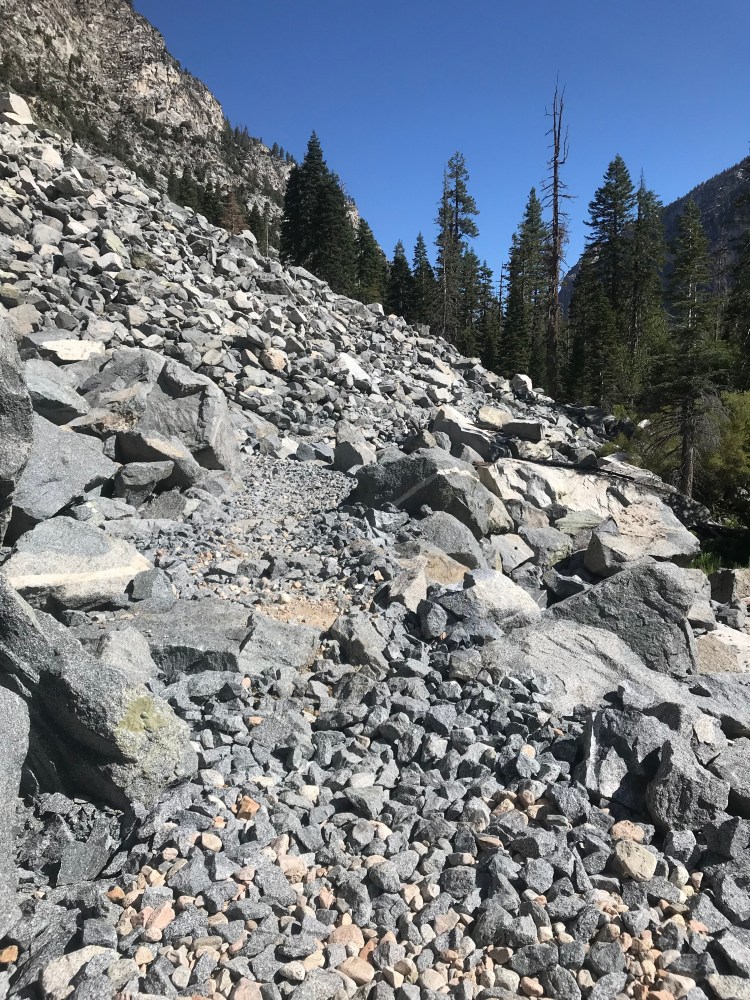
I enjoyed the views for a bit, and then began scouting my descent down the north side of the pass. Switchbacks that were clear at the top soon disappeared under the snow. To the left of the snowfield, the pass consisted of a steep pile of boulders and talus that appeared unstable. To the right, the snow had pulled away from the rock, forming a chute. I opted to scoot down the chute rather than scramble down loose boulders and risk triggering a rockslide.
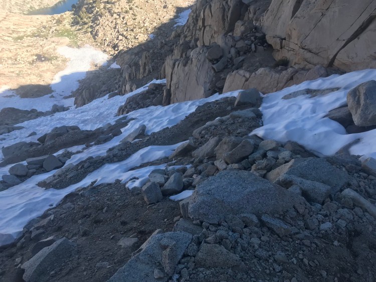
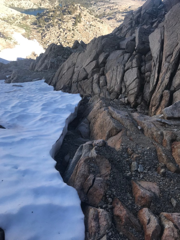
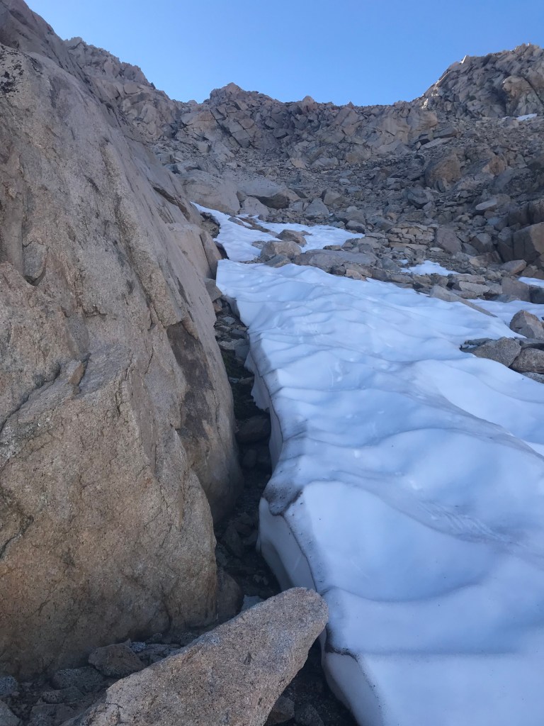
Eventually I ran out of chute to scoot through and realized that if could cross to the other side of the snow field, I’d be able to pick up the switchbacks again. Thankfully, I found a narrow spot, only about 10 feet across, and was able to use my trekking poles to carve out flat spots for my feet. I left my pack behind, tied to some cording, and made my way carefully across the ice.
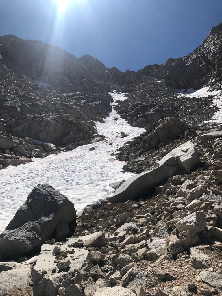
The whole ordeal was about ten percent beyond my comfort level. But I took my time and made thoughtful choices. Aside from tearing a hole in my pants, I came out unscathed, and proud of my ability to stay cool in a potentially treacherous situation.
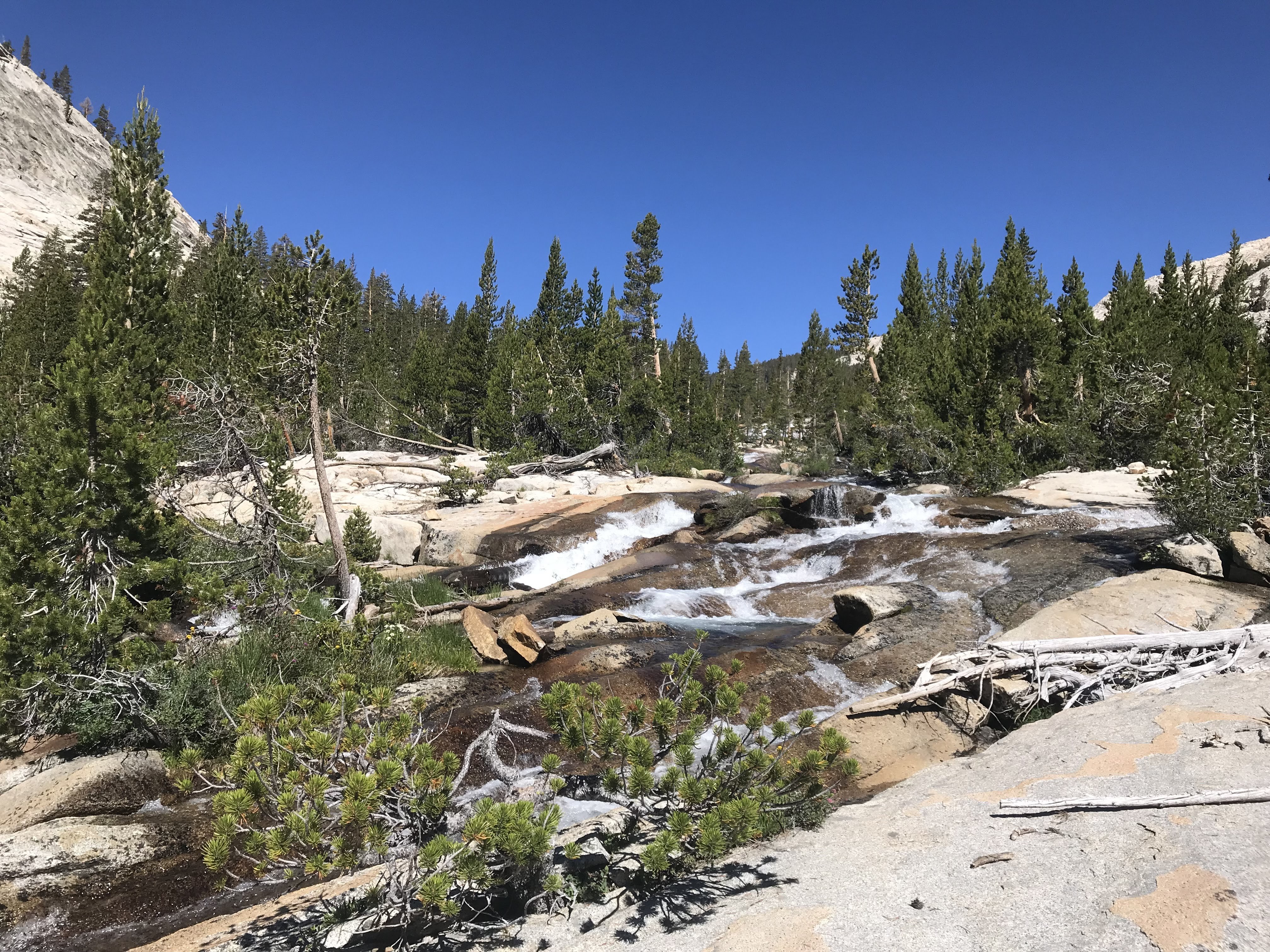
After traveling just 2.5 miles in 4.5 hours, I reached beautiful Colby Lake.
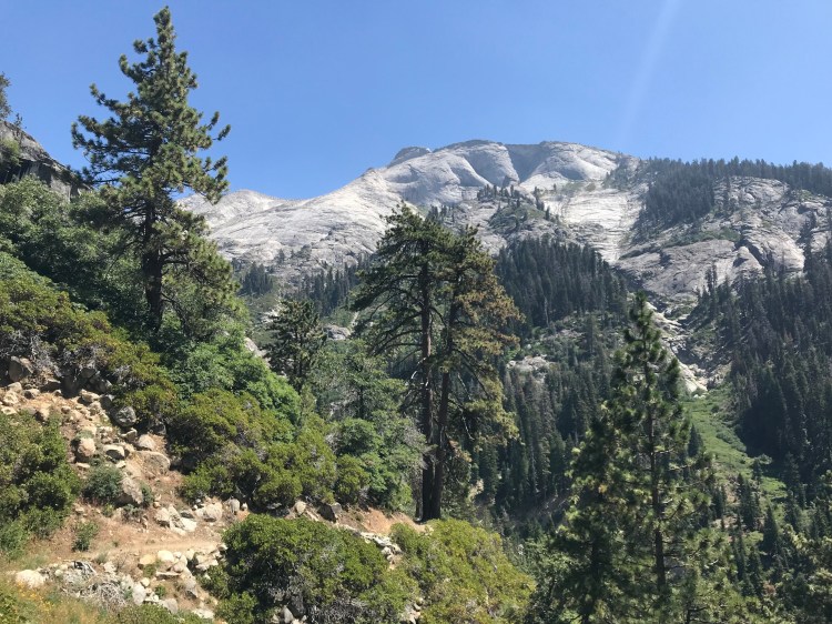
The rest of the day was down, down, down through some incredible Sierra scenery.
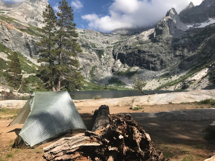
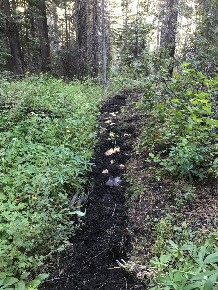
After miles of descent through sometimes extremely muddy trails, I camped below the Whaleback at Big Wet Meadow. All told, I covered 6 miles and lost over 3,000 feet of elevation. I enjoyed a nice sunset as little fish jumped in the creek. I treated myself to mac n’ cheese, my favorite of all the dinners.
Day 6: Big Wet Meadow to Sphinx Creek
I left Big Wet Meadow at 6:30 a.m. The day started with a very muddy descent to Roaring River.
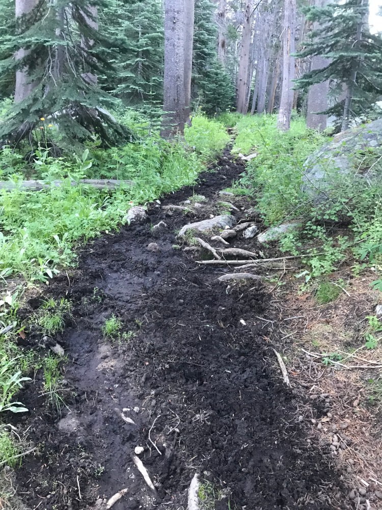
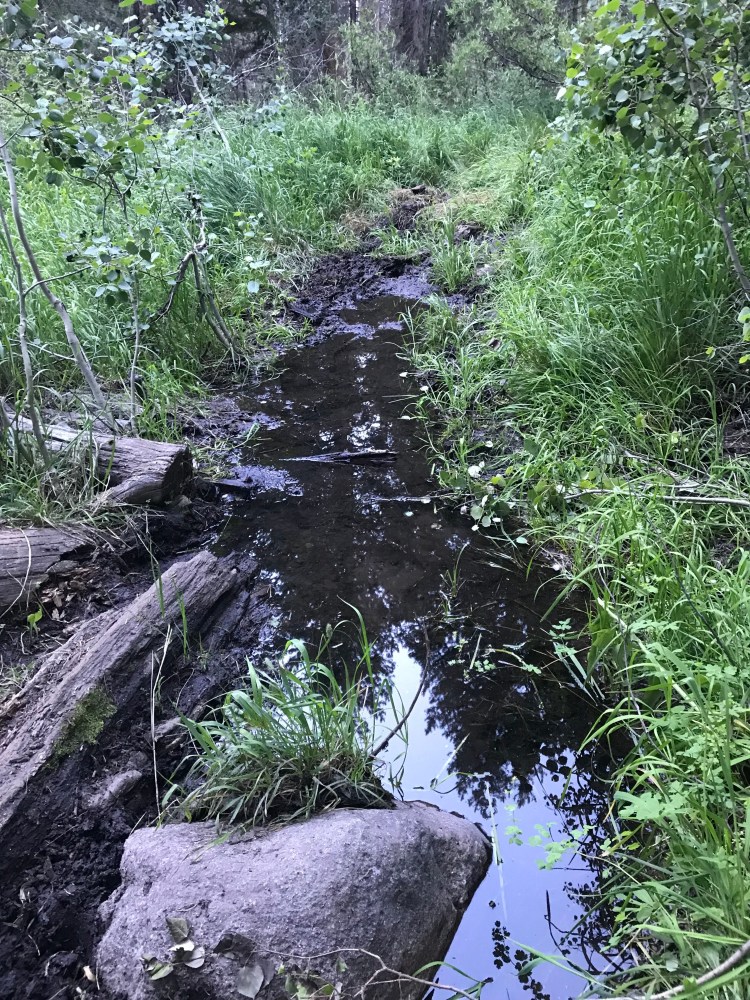
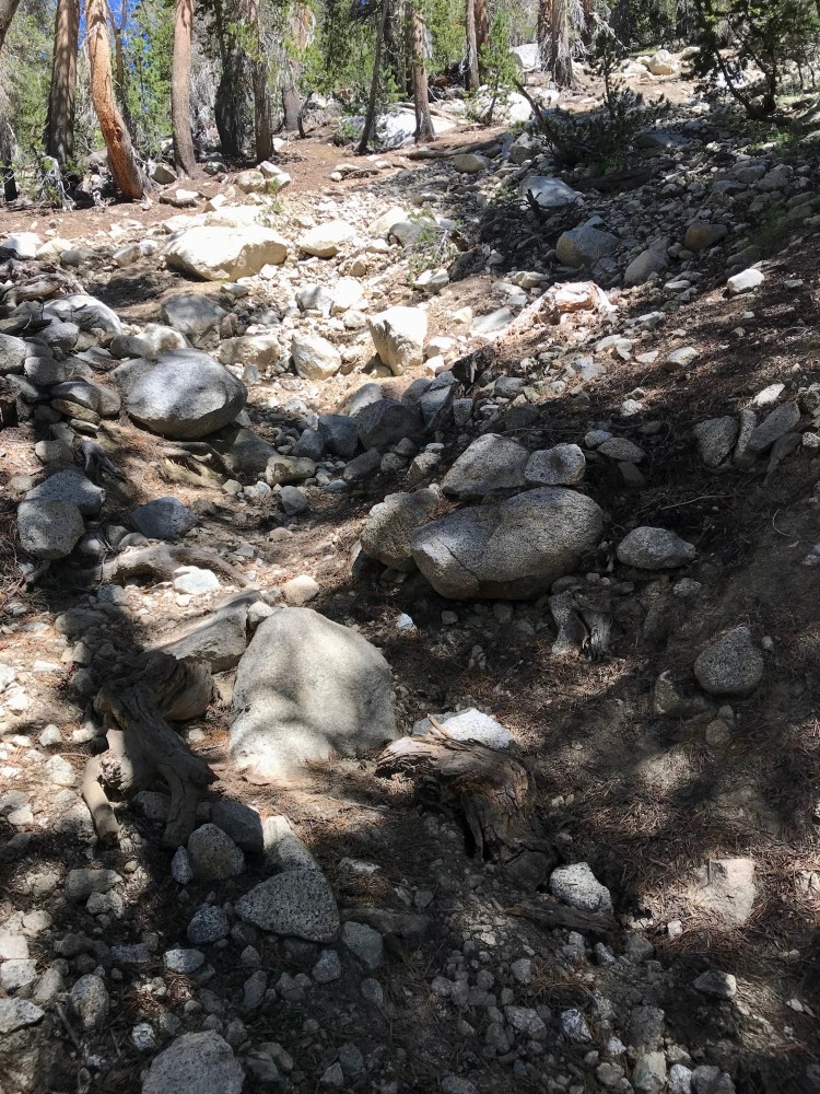
This was followed by a hot and dusty 3,000-foot climb to Avalanche Pass. At this point I built a mental list of what “unmaintained trail” means:
- poorly graded
- often faint
- often degraded
- sometimes muddy
- slow going
And what is needed in order to travel on unmaintained trails:
- patience
- careful observation (“That flattened bit of grass up there is probably the trail.”)
- trail sense (“If I were a trail, which way would I want to go?”)
- map reading skill (“Forget the trail. What’s the best way to get to this spot?”)
It gave me a new appreciation for all the work that goes into trail maintenance, and how much more time you get to focus on the scenery rather than on navigation and safety.
After 13 miles rather unscenic miles, I arrived at Sphinx Creek, where I would camp for the night with a gajillion mosquitoes. Otherwise it was a lovely little area and I had it all to myself. In fact, I hadn’t seen a single human today!
Day 7: Sphinx Creek to Road’s End
My last day out on the trail, and my 40th birthday! A 6-mile descent to Road’s End would bring me to the end of what proved to be a challenging week. While it was mostly forested, there were glimpses of views along the way.
The mosquitoes along Bubb’s Creek kept me moving at a quick pace.
The number of hikers increased the closer I got to the trailhead, so I just kept moving right on along. About two mile from Road’s End, I came across another bear. What a perfect bookend for this trip — one bear two miles into the trip, and another bear two miles from the end.
I reached Road’s End by noon and waited for my ride. I had communicated my route change to my husband via my Garmin inReach, and he showed up with ice cream, Gatorade, fruit, and a small pile of birthday cards from the family. A sweet end to a tough trip that challenged and rewarded me.
